
Sectors
Infrastructure
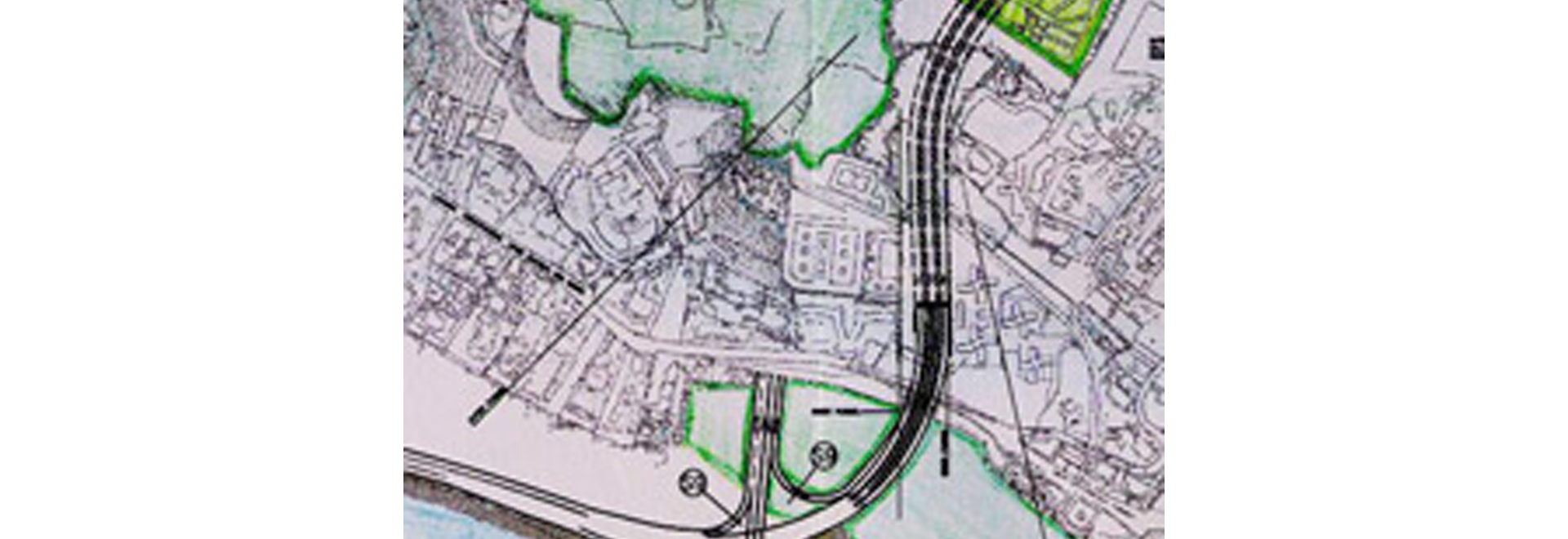
The proposed freeway along the western coast of Mumbai between Nariman Point to Worli is about 13.4 kms long, having 6 lanes for two-way traffic. It includes 620 m long tunnel under the Malabar hill, seven interchanges and four major bridges. To protect the freeway from the attack of sea ways, sea wall was proposed.
Considering peculiar traffic conditions prevailing in Mumbai, it was proposed to provide three carriageways of 2-lanes each which would allow flexibility in providing 4- lanes in peak directional traffic during peak hours. This would provide better traffic facilities for a longer period.
The freeway was designed as toll road. Toll plazas were planned at all the entry points to the freeway.
Geometrics of the freeway were designed for a design speed of 100 kmph whereas, the geometrics of the tunnel alignment were designed for a design speed of 80 kmph. For the tunnel, special lighting, ventilation and survelliance system was proposed.
Traffic surveillance was also considered for the entire stretch of the freeway, while planning.
© Tata Consulting Engineers Limited. All Rights Reserved | Site Credits:DV


